View Larger Map
Thursday, November 21st – Ezurum to Dogubeyazit (bus)
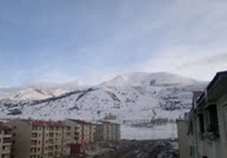
The morning air bites me as I step out the door of our hotel. There is a dusting of snow on the higher patches of ground and frozen puddles in the lower parts. The hills outside the town are white with snow down to the edges of town. My nose hairs are freezing together.
The three of us walk around to the rear of the building with our many bags in hand to the storage area where we collect our bikes. I am always worried that mine might be stolen since I only have a cable now instead of a U-lock, but Coen has locked his and mine together with his U-lock, Vincent has U-locked his to a railing and I have entwined all three together with my cable. It's a mess to sort out in the frozen dawn with bare fingers, but it works.

We coast over the dirt strewn roads to the bus depot, which we have directions to from the hotel staff. The bus to Dogubeyazit leaves at 9:30, in two hours. We buy our tickets and then look for a breakfast place where we can get something to eat and a coffee. It's a shabby looking city with few to no Western fast food outlets. Still, we find a café that offers something similar to a Western breakfast and strong Turkish coffee. Coen and Vincent are still waking up. They sit quietly assessing the situation on the street outside.
Erzurum has been inhabited for thousands of years, long before London, Paris or Rome. In spite of its great age, the guide says there isn't much to see here: a remnant of a Roman tower, the foundation of a Hittite ruin, an eighteenth century palace outside the town and a Seljuk holy school with twin towers from the 1200s that stands in the centre of town. The latter is the most famous landmark in town. We have time to ride by it and to visit the courtyard of the medieval citadel nearby before boarding our bus to Dogubeyazit.

The bus is heated, thankfully, and quite crowded. Fortunately, it will only be a five hour ride. Shortly after we leave Erzurum, sleet begins to fall but it only lasts half an hour. Our highway leads back into the mountains but after a brief climb it begins to descend. The route is mountainous most of the way, rising and dropping over and over, but it clears up and much of the snow disappears.

The bus stops in many small towns along the way. We are sitting near the front where it is easy to get off and on. The driver tells us how long we will stop when we ask so we are able to get off and stretch, always leaving one of us on board to watch our bags. At several stops there are messy arrays of market tables with food, clothing and souvenirs for sale. As we move east, it seems to warm up a bit and there is less snow.


I first see Mt Ararat half an hour before we reach Dogubeyazit. It is a mountainous region but Ararat is a good 2000 m higher that the surrounding mountains, so it sticks its white, cone-shaped head up from behind the other mountain tops whenever we are at the top of a hill. According to my detailed map, there are no mountains close to it. It is a massive shield volcano with gentle sloping sides, like the volcanoes on the island of Hawaii. It must be 150 km around at its base. Seeing its peak so far away above the closer mountains really exemplifies its incredible height of 5,100 m.
Ararat disappears when our road drops down into the valley that leads to Dogubeyazit. We only see it again when we arrive in the town. It doesn't look nearly as high now, since its slopes are so gentle, but it is still 15 km away and is much more massive than it first looks.

Dogubeyazit is smaller than Erzurum, but still a sizeable town with lots of retail. The retail is largely open air markets and small street kiosks and stalls. The inn we find a room in is a ramshackle affair badly in need of a paint job, but it works. This is Asia, not Europe.
The people here are mostly Kurds, unlike the Armenian-murdering Turks of Erzurum. In this cold, damp season I keep my kafia around my neck at all times. It is here I am made aware that the kafia, made in Kurdistan, is a symbol of solidarity with the Kurdish independence movement. Kurds here are especially grateful to foreigners who seem to be sympathetic. Here I thought they are just super friendly people.

Kurdistan is a large region divided up between Turkey, Iraq, Iran and Syria, with the largest part being in Turkey. They have their own language, which is not allowed to be used in Turkish schools. They are the last major ethnic minority that the Turks are still oppressing. This is one of several reasons why Turkey's repeated applications for admittance into the EU have been rejected. The Kurdish political party, the PDK, is not legal here but practically everyone in this region of the country supports it.
I have heard this cute story but I doubt it is true. The colours of the independence movement are green, yellow and red and the government tends to crack down of any symbolic displays of these colours. I was told that traffic lights here have been changed in some regions of the SE corner of the country to blue, yellow and green. They are definitely green, red in blue in this town.
This will be our last night in Turkey. Tomorrow night we will be in Iran, which only has been letting in foreigners like Canadians for the last three years since the revolution in 1980 when the Shah of Iran was deposed by the Ayatollahs. We plan to ride to the border from here, which is approximately 65 km. I am very excited about it, and a bit anxious about crossing the border. If we are going to have trouble, it will be there.
PHOTO 1: the Citadel at Erzurum
PHOTO 2: snowy hills above Erzurum
PHOTO 3: on our way out of town
PHOTO 4: Selchuk Bridge
PHOTO 5: Vincent shopping at one of our stops
PHOTO 6: one of the canyons along the way
PHOTO 7: outdoor market in Dogubeyazit
PHOTO 8: Mt Ararat and Little Ararat

No comments:
Post a Comment